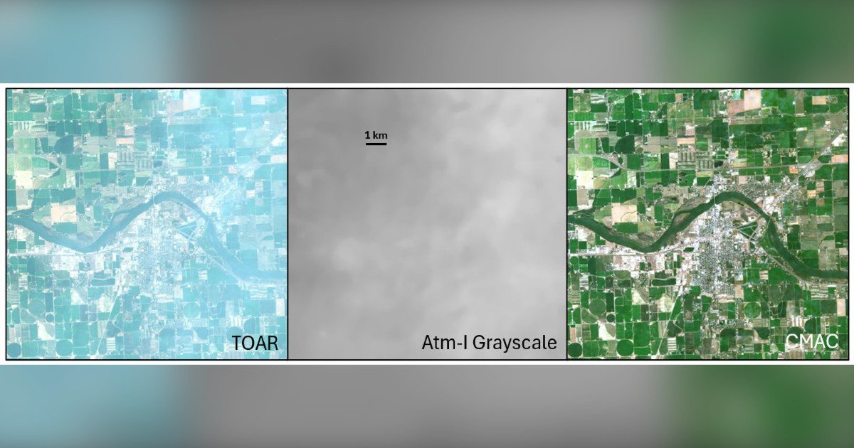
A new open-access paper from Resolv, Inc. argues that the long-standing promise of precision agriculture through satellite imagery can be realized by making accurate surface reflectance the standard output, rather than the exception. The paper, titled “Surface Reflectance: An Image Standard to Upgrade Precision Agriculture,” was published March 30 in Remote Sensing by Dr. David Groeneveld and Tim Ruggles of Resolv. It benchmarks three atmospheric correction methods on Sentinel-2 imagery and outlines how a reliable correction standard could unlock low-cost, fully automated crop intelligence.
Atmospheric correction is critical because light traveling through the atmosphere distorts the signal before it reaches a satellite sensor. Correction reverses this distortion, returning data to surface reflectance—the measurement needed for accurate crop analytics. When correction is off, small clouds and shadows can be mistaken for crop problems, triggering false alarms that waste time and money. Automated analysis has struggled to differentiate bad data from real issues, stalling the adoption of precision agriculture.
The Resolv team compared two mainstream tools, Sen2Cor and FORCE, against CMAC, the closed-form method for atmospheric correction developed by Resolv and being readied for commercial release. Across a wide range of atmospheric conditions, CMAC produced precise and accurate surface reflectance estimates, while the mainstream methods showed systematic error—over-correcting clear images and under-correcting hazy ones. This bias had gone undetected until this paper, according to the study.
Reliable surface reflectance enables several proof-of-concept applications detailed in the paper: automated removal of clouds and cloud shadows to cut false alarms; an automated crop start-date index that could replace growing-degree-day scheduling; stable NDVI readings even when atmospheric water vapor varies; soil capability classification directly from imagery for variable-rate seeding and fertilization; and accurate remote crop irrigation based on greenness and reference evapotranspiration to save water and reduce costs. These applications could make precision agriculture pay for itself.
High image costs are another barrier, and the paper proposes a tiered model to reduce them. Tier 1 uses free Sentinel-2 imagery corrected to surface reflectance. Tier 2 fills gaps with commercial smallsat data when clouds block Sentinel-2, with data resampled to match, verified, and billed automatically with no human intervention. This turnkey pipeline could order, correct, analyze, track, and bill imagery across vast regions, sharply lowering service costs while increasing image sales volume. Crop insurance could serve as a natural channel, streamlining loss adjustment and bringing more acreage under active management without compromising grower privacy.
“Remote sensing has spent years over-promising and under-delivering for agriculture,” the authors state. Reliable surface reflectance imagery, they argue, can finally close the gap. The paper is available at resolv.com for review.